Advanced Uses of Digital Technologies in Structural Engineering
Bligh Tanner has been fortunate to have an opportunity over the last 12 months to work closely with Ravenswood Gold to provide engineering solutions for the preservation of three heritage listed chimneys.
One chimney in particular, Sunset No. 2, required external (reversable) protection and stabilization in the form of a steel cage constructed around the perimeter of the chimney. The frame served to provide protection from risk of impact from fly rock, provided for continual access to the full extent of the chimney and can be used to temporarily support the chimney during blast operations.
The traditional documentation workflow for a structure like this would be for the client to engage a surveyor to provide a survey at ground level and at predetermined locations up the chimney. This would provide geolocation ( northings and eastings), the outline of the chimney at its base and some reference locations for heights of the chimney.
From survey we would be able to build a model and provide structural documentation. However, the structural model would only be idealised and not represent the exact geometrical conditions of the 100+ year old chimney. A shop detailer who would then scan the structure (point cloud) to re-build the model and allow for exact site conditions and geometry of the existing chimney.
With this project we have cut out additional workflows by simply working off the point cloud from the start. Our structural model was build directly from the point cloud, taking into all misalignment of the existing chimney. No additional site survey or measurements were required in order to do structural design and documentation.
Our model and the point cloud were provided directly to the shop detailer who used these two items to shop detail and fabricate the steel frame confirming tolerances as required. This process dramatically sped up workflow and provided us with structural and dimensional certainty with how the frame would be fabricated.
The overlay of the proposed steel frame onto the point cloud also allowed Bligh Tanner to create a video fly-through which provides the viewer with a photo realistic interpretation of the final methodology. The use of this technology has assisted in expediting the Department of Environment and Science (DES) approvals by providing clear visual interpretation of the temporary structural works proposed to be constructed around the heritage structure.
The use of a point cloud for this type of project is invaluable and will undoubtedly become common place in the coming years.
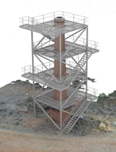
3D Render using point cloud and structural revit model. Rendered using 3DS Max.
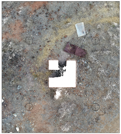
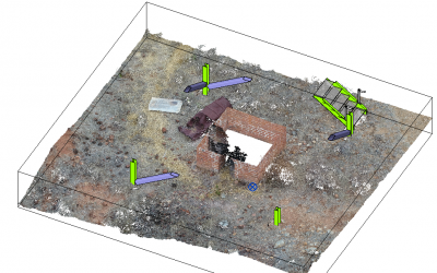
Snip from Revit showing plan view of point cloud and location of structural bored piers located from data contained within point cloud
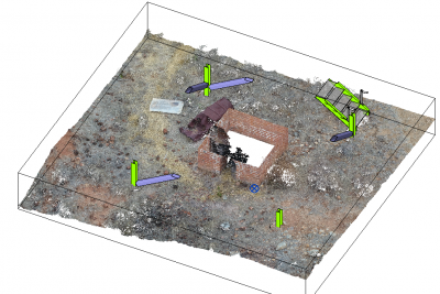
Snip from Revit showing point cloud and base structure.
Allowing accurate modelling of footing levels and locations of structural steel to suit ground conditions. Bored piers/footings have been located just below ground level to allow the steel frame to be removed at a later date and bored piers/footings to be covered leaving the heritage listed site visually untouched.
Contact Simon Kochanek for further information.
